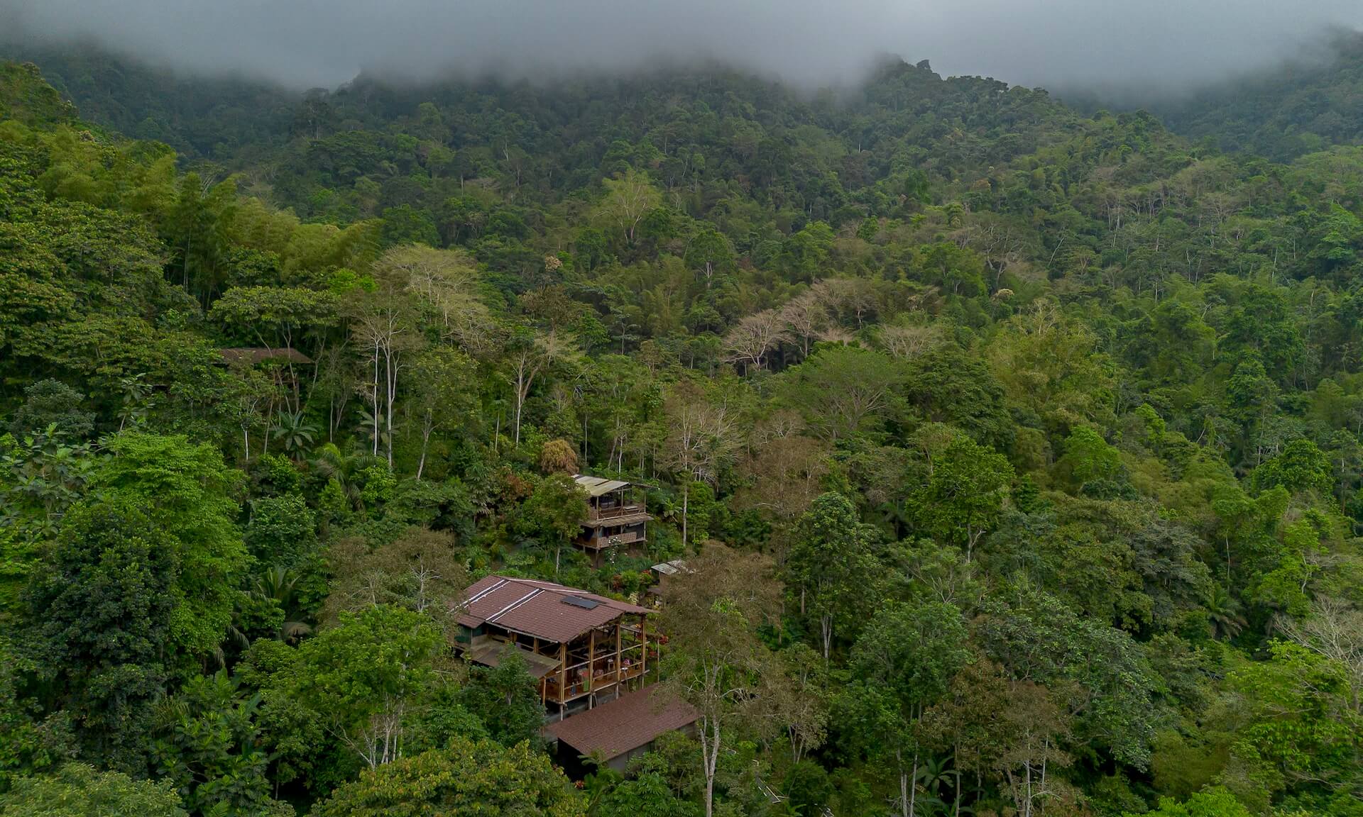
The Jama-Coaque Reserve (JCR) is a rainforest preserve that protects one of the last major remnants of the Pacific Forest of Ecuador. It currently covers an area of 2,900 acres (1,172 hectares) along Ecuador’s coastal mountain range. It safeguards two different types of chocó rainforest: premontane cloud forest and moist seasonal evergreen forest.
JCR was created by Third Millennium Alliance (TMA) in 2007 and is managed in partnership with the community of Camarones. The goal is to expand JCR to 5,480 acres (2,218 hectares) by the end of 2026.
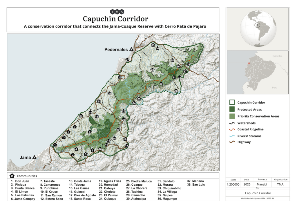
JCR is also the nucleus and key anchor point of the Capuchin Corridor, which covers 100,000 acres (40,000 hectares) along the coast of the Pacific Ocean between the towns of Jama and Pedernales in the province of Manabí, Ecuador.
Pronunciation Note: The “J” in Jama sounds like an “H”—just like in the Spanish name Jose or the word Jalapeño. Jama-Coaque is pronounced Hama Koh-Ah-Kay. It’s actually a fun word to say. The acronym (JCR) is also commonly used.
At a Glance
- Current area: 2,900 acres (1,172 hectares)
- Location: Municipality of Jama, province of Manabí, coastal Ecuador
- Coordinates: -0.115098°, -80.121154°
- Founded: 2007
- Management: Third Millennium Alliance (TMA) in partnership with the community of Camarones
- Elevation range: 548 – 2,290 feet (178 – 698 meters) above sea level
- Topography: mountainous
- Forest types: premontane premontante cloud forest and seasonal moist evergreen forest
- Global Biodiversity Hotspot: Tumbes-Chocó-Magdalena
- Ecotone: Choc
- Bioregion: Pacific Forest of Ecuador
- Ecoregion: NT0178 Western Ecuador moist forests
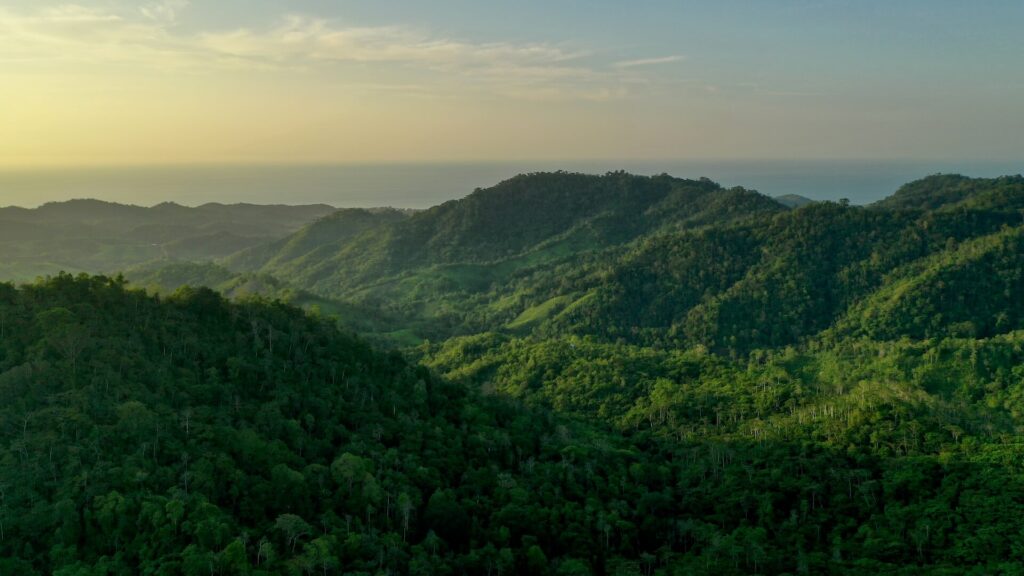
The Jama-Coaque Reserve in the Pacific Forest of Ecuador.
Contents
- Ancient History
- Creation of the Jama-Coaque Reserve
- Funding & Technical Partners
- Geography
- Hydrology
- Climate
- Biodiversity Hotspot
- Ecoregion
- Cloud Forest
- Moist Forest
- Endangered Species Designations
- Research
- Agroforestry & Cacao
- Reserve Management
- Capuchin Corridor
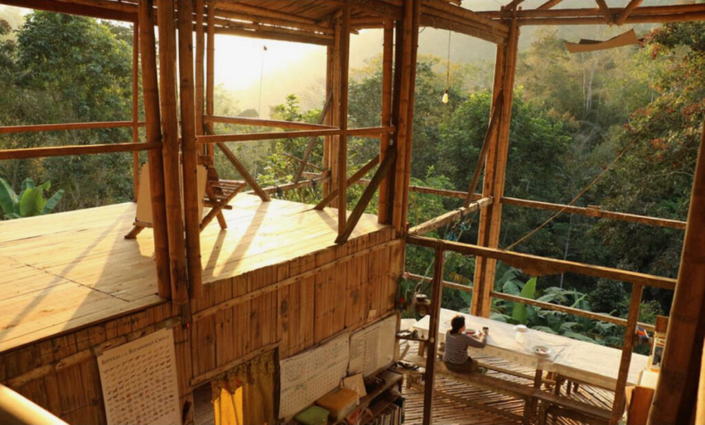
The Bamboo House at golden hour (circa 2019).
Ancient History
The Jama-Coaque Reserve is named in honor of the ancient civilization (posthumously named Jama-Coaque) that thrived in this region from 355 BCE to 1532 CE. Tragically, the Jama-Coaque culture abruptly collapsed and almost entirely disappeared immediately following the arrival of Spanish explorers. No written or oral records from their culture have survived, but historians surmise that most Jama-Coaque settlements were concentrated at the base of the mountains close to the sea, whereas the rugged forested land that is now JCR was primarily used as wild hunting grounds.
The Jama-Coaque people did, however, leave behind an abundance of ceramic sculptures and iconography, which is well-regarded by archaeologists and art historians. Pieces of clay pots and other ancient artifacts from their civilization have been unearthed in the area surrounding the Bamboo House.
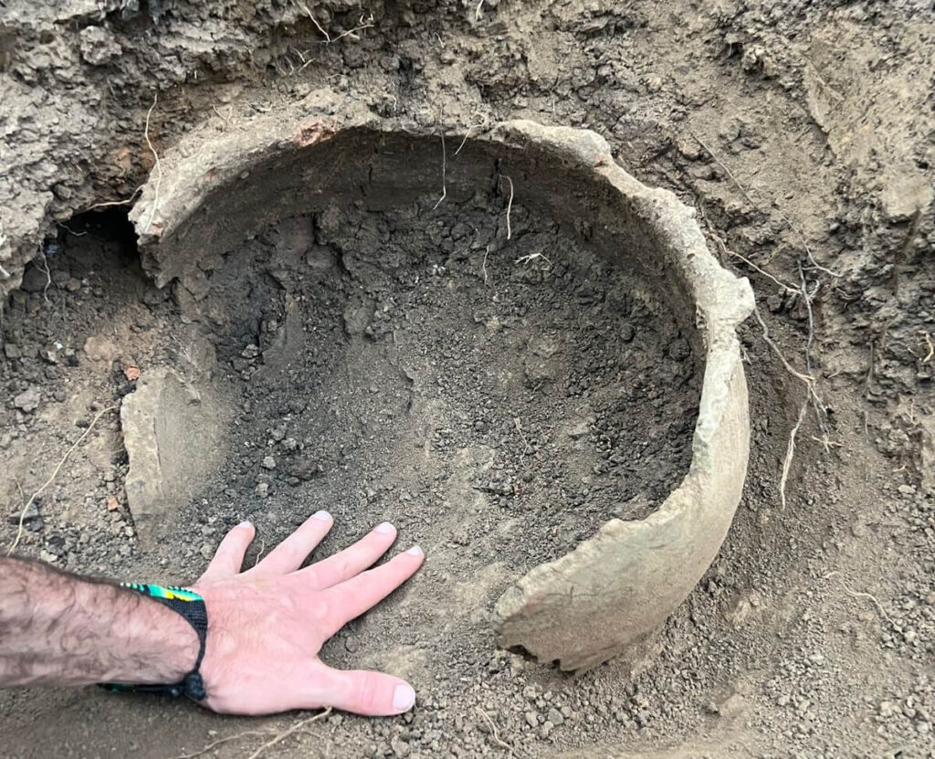
Clay pot from the ancient Jama-Coaque civilization unearthed in JCR in 2024.
Creation of the Jama-Coaque Reserve
In 2007, Isabel Dávila, Jerry Toth, and Bryan Criswell co-founded the Ecuador-based nonprofit conservation organization Third Millennium Alliance (TMA). Later that same year, they were introduced to the land that is now the Jama-Coaque Reserve (JCR). At the time, it was forested land that was owned by absentee owners and effectively abandoned. The three co-founders raised $16,000 from friends and family to purchase a 100-acre property at the very top of the mountain, where they spent the next few months living in tents, learning the land, and meeting their neighbors.
The following year, they purchased three more properties. On one of those properties, they began building a research station constructed primarily with native bamboo sourced from the site and using only hand tools. The research station—affectionately named the Bamboo House—became JCR’s field headquarters and visitor lodge. They, along with friends and other early visitors, planted a food forest with 50 different species of fruit trees in the one-hectare area of land immediately surrounding the house.
Over the years, both JCR and TMA continued to steadily grow. Thus far, TMA has purchased and integrated into JCR a total of 30 different properties, all of which were previously owned by absentee landowners, most of whom didn’t even live in the same region. As of 2025, JCR covers nearly 3,000 acres (1,200 hectares).
You can read the entire origin story of JCR in How We Made a Rainforest Preserve.
Funding & Technical Partners
The people and institutions that have been the most important in the creation, expansion, and ongoing management of the Jama-Coaque Reserve are the Richard and Nancy Arnoldy Foundation, IUCN-Netherlands, the “5-year Sponsorship” Group, Saving Nature, the world-renowned muralist Youri Cansell (aka Mantra), the artisanal design company Craftspring, and the Capuchin Collective, with invaluable support and guidance provided by Lookfar Conservation.
Overall, several hundred sponsors, reseachers, interns, and other professionals have financially and technically supported the Jama-Coaque Reserve over the years, both from within Ecuador and abroad.
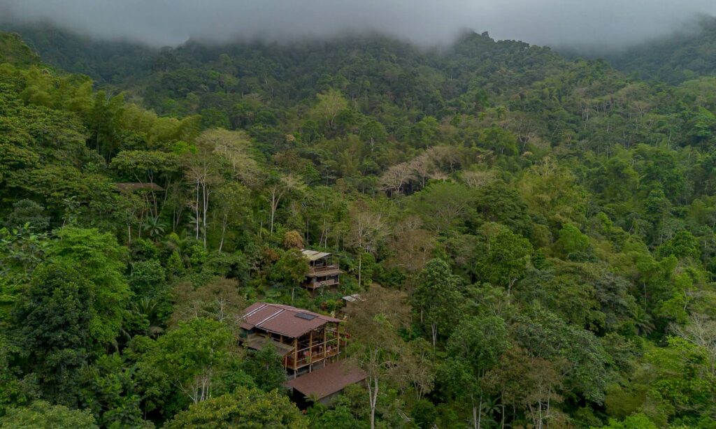
Bamboo House research station in the Jama-Coaque Reserve (2024).
Geography
Across the entire length of coastal Ecuador, there are three major mountain ranges. The Mache-Chindul mountain range occupies the rainforested northern coast. The Chongon-Colonche mountain range is located in the mostly dry and semi-deciduous southern coast. The Jama-Coaque mountain range is located between the two, in the northwest corner of the province of Manabí. It represents the ecological transition between those two vastly different iterations of the Pacific Forest of Ecuador.
The Jama-Coaque mountain range is also the only stretch of coastal mountains where the peaks reach their zenith within a mere 8 kilometers of the sea. This elevational gradient, combined with its position at the midpoint of the Choco-Tumbes transition zone, has the effect of compressing an extraordinary degree of ecological diversity into a relatively small area.
Hydrology
JCR protects the entirety of the headwaters of the Camarones River, as well as the headwaters of numerous other small rivers and streams that support five agricultural communities, including Camarones, Tabuga, Estero Seco, Aguas Frias, and Purichime. All rivers empty out into the Pacific Ocean.
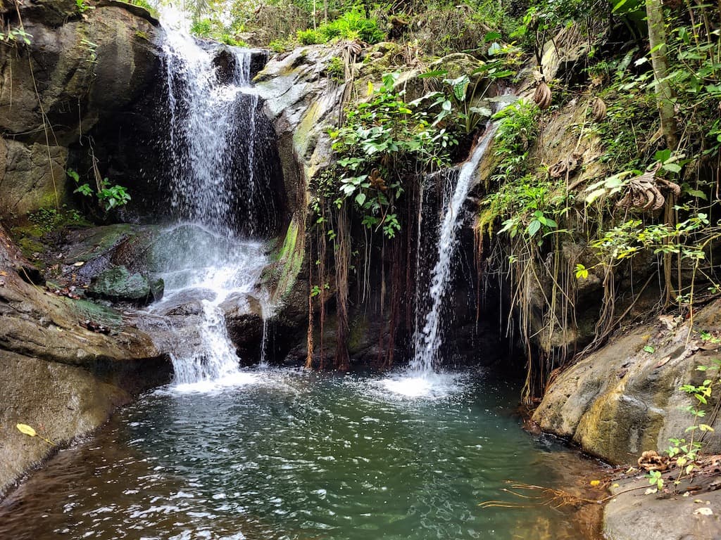
Waterfall in the Camarones River (Jama-Coaque Reserve)
Climate
The Jama-Coaque Reserve (JCR) is subject to a tropical monsoon climate, which is primary driven by two Pacific Ocean currents that clash immediately offshore. Typically starting in late December, a change in atmospheric pressure shifts ocean currents so that warm waters from the El Niño current come closer to shore and displace the cold waters of the Humboldt current. The result is warmer air temperatures and heavy rainfall that peaks in February and March and can linger into May and June. The dry season, which generally begins in June or July and can last into December or January, is characterized by cooler temperatures and more overcast skies.
The weather station at the Bamboo House records an average daily temperature range of 22–28°C (72–83°F) in the rainy season and 20–26°C (68–78°F) in the dry season. The year-round average temperature is 74°F (23°C).
Annual rainfall in the lowland moist forest surrounding the Bamboo House ranges between 800-2,200 mm, with an average more in the range 1,000-1,500 mm. The total annual water intake of the cloud forest, however, is estimated to consistently exceed 2000 mm, owing to fog drip. Fog drip is the process by which vegetation strips moisture from clouds that shroud the mountain peaks, condensing it into water droplets that fall to the forest floor.
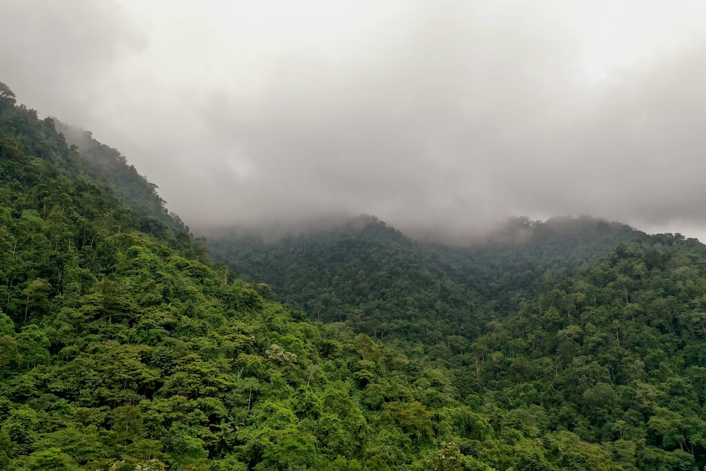
Cloud forest along the peaks of the in Jama-Coaque Reserve
Biodiversity Hotspot
The great Chocó rainforest runs along the Pacific coast of Colombia and extends into northwestern Ecuador, bounded by the western slopes of the Andes and the peaks of the coastal mountain range. The Colombian Chocó is among the wettest rainforests on earth. It competes with the upper Amazon as the most biodiverse place on earth.
As the Chocó moves southward into coastal Ecuador, it gradually transitions into the moist evergreen forests of Manabí until it is eventually subsumed by the dry and deciduous “Tumbiesian” forests of Santa Elena and Guayas, which ultimately extends as far as northern Peru.
The global conservation community has named this area the Tumbes-Chocó-Magdalena Biodiversity Hotspot. It describes the wildly dynamic ecoregion that stretches from the ultra-wet Chocó rainforest on the coast of Colombia to the Tumbesian dry forests on the northern coast of Peru.
The Pacific Forest of Ecuador is the central part of this biodiversity hotspot and contains within it both the wet and dry extremes, and many gradients in between. It is, thus, a medley of different types of tropical forests. To see what we mean, check out our Photo Tour of the Pacific Forest of Ecuador.
The Jama-Coaque Reserve (JCR), located in the heart of the Pacific Forest of Ecuador, is the geographic and ecological midpoint between the Chocó and Tumbes extremes. This effect is accentuated by the sharp elevational gradients created by the rugged topography of the coastal mountain range. At higher elevations, JCR represents the southern-most extension of the coastal Chocó wet forest. At the base of the mountain (less than a kilometer below the lower limits of JCR), Tumbesian deciduous forest is present.
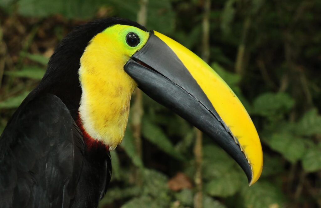
Chocó toucan (Ramphastos brevis)
Ecoregion
The Ecuadorian Coastal Forests & Flooded Grasslands bioregion is part of the Andes & Pacific Coast sub-realm in South America and is comprised of five ecoregions. One of them is called “NT0178 Western Ecuador moist forests,” which describes the Jama-Coaque Reserve (JCR). Interestingly, the official ecoregion map, published by One Earth and World Species, incorrectly places JCR just outside the border of NT0178 and instead places it inside the ecoregion named “NT0214 Ecuadorian dry forest.”
This understandable oversight serves to highlight the dramatic ecological transitions that occur across short distances in coastal Ecuador. These shifts are driven largely by elevation changes along the coastal mountains. In the Jama-Coaque mountains, the upper elevations are best classified as part of the “NT0178 Western Ecuador moist forests” ecoregion, while the lower elevations, extending down to the shores of the Pacific Ocean, are more consistent with the “NT0214 Ecuadorian dry forest” ecoregion. The ecological transition between these two ecoregions typically occurs between 650 and 950 feet (250 to 300 meters) above sea level.
The rich and complex ecological mosaic of coastal Ecuador is the reason why most conservationists in the region prefer the term Pacific Forest of Ecuador. This term invites all of the many different types of forest in this bioregion (including Chocó rainforest and cloud forest, moist seasonal evergreen forest, semi-deciduous forest, Tumbesian dry forest, and coastal mangrove forest) under one roof. Remarkably, all of those forest types can be encountered along the Jama-Coaque mountains, which is where all of these forests converge. JCR, which occupies the upper elevational half of the mountains, is premontane cloud forest and moist seasonal evergreen forest. The Regiones Naturales de Ecuador classification system by Pontificia Universidad Católica del Ecuador (PUCE) classifies both of these forests as Bosque Húmedo Tropical del Chocó (Chocó tropical rainforest).
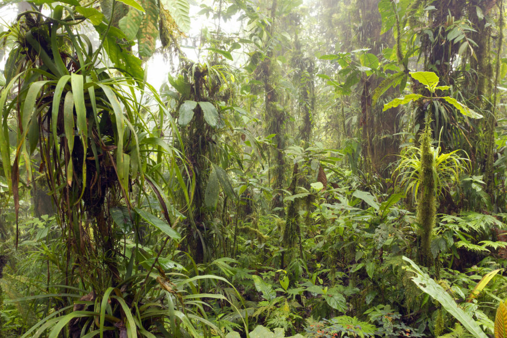
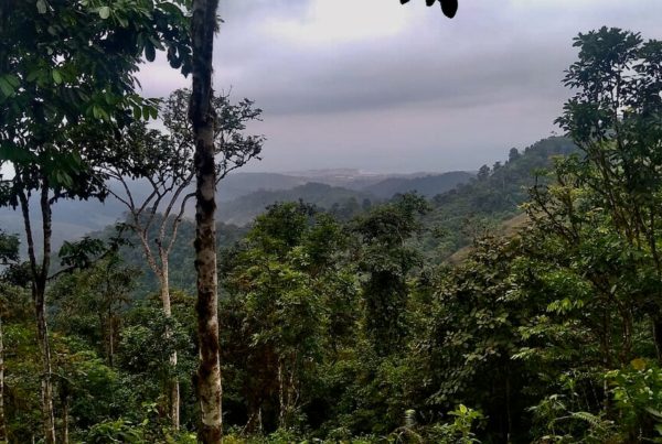
Cloud forest in the Jama-Coaque Reserve
Premontane Cloud Forest
The Jama-Coaque Reserve (JCR) includes two different types of “Chocó” tropical forest. The peaks of the mountain, which are often shrouded by a thick blanket of fog, are characterized by premontane cloud forest.
It is, in a very real sense, a forest that is fed by the clouds. Almost all visible surfaces are covered in bright green vegetation of many different forms. The forest floor is carpeted with ferns, tree trunks are encased in moss, and epiphytes, orchids, and bromeliads hang from the branches. All of the above is watered on an hourly basis by clouds of fog that float up from the Pacific Ocean and condense into water droplets on the leaves of the trees. The droplets then drip down into the soil and form the basis of the waterways that sustain the life of all animals downstream—humans included.
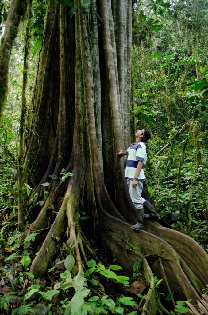
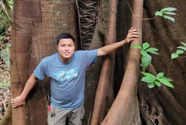
Strangler Fig (Ficus sp.) in the Jama-Coaque Reserve.
Moist Seasonal Evergreen Forest
The elevation range of the cloud forest is 1,700-2,200 feet (515-698 feet) above sea level. At around 1,700 feet (515 meters), the vegetation transitions to what is most accurately called moist seasonal evergreen forest.
The terminology deserves a brief explanation. In their seminal 1991 report “Biological Extinction in Western Ecuador,” the famous botanical duo C.H. Dodson and A.H. Gentry referred to the mid-elevational forest of JCR as “moist forest.” This term was also used by the renowned cast of ecologists who authored another seminal report about the Pacific Forest of Ecuador, which was spearheaded by Conservation International, titled “Status of Forest Remnants in the Cordillera de la Costa.”
A few decades later, a team of national botanists in Ecuador, who were given the mission to classify every single forest type in the country, officially classified JCR’s lowland forest as “seasonal evergreen forest of the Pacific Equatorial coastal mountain range.” This term is certainly more descriptive, but not always practical in conversation. The authors of the Regiones Naturales de Ecuador, meanwhile, classify JCR’s moist forest as “Chocó rainforest.”
In this confusing miasma of forest terminology, the formal term we prefer is “moist seasonal evergreen forest.” In less formal occasions, we often simply use Dodson and Gentry’s term: “moist forest.”
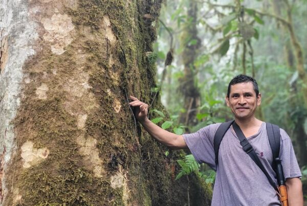
The moist forest is an entirely different world than the cloud forest, even though the transition between the two is often less than 75 meters of elevation difference. The vegetation is evergreen like the cloud forest, but there’s a wider range of color tones, and there is also a somewhat different range of species. The trees are generally taller here, relative to the cloud forest. The canopy of the moist forest is formed by giant native trees like strangler figs, some of them reaching heights of 45 meters (150 feet), often with massively buttressed roots. Other trees, like Moral Fino (Maclura tinctoria) have wood that is so dense that it’s impossible to pound a nail into it without first greasing the nail with vegetable oil.
There is also a wealth of exotic palm trees, some of which have trunks armed with needles like a porcupine. Another endemic palm tree known as tagua (Phytelephas aequatorialis) produces nuts that taste like coconut when ripe but then later harden into the color and consistency of ivory. Stands of giant bamboo (Guadua angustifolia) intermingle with rubber trees (Castilla elastica) that ooze white latex when injured. Threading through this steep and rugged landscape are countless little streams that tumble down boulder-strewn slopes, alternating between waterfalls and quiant little swimming holes that are teaming with freshwater prawns. The water in these streams is so pristine that you can drink it straight from the river.
All of this exists under the watchful eyes of loud-mouthed troops of howler monkeys, critically endangered Ecuadorian capuchin monkeys, long and powerful members of the weasel family with yellow heads called tayras, and wild felines like ocelots and margays that are rarely seen except in pictures taken by infrared trail cameras fitted with motion sensors.
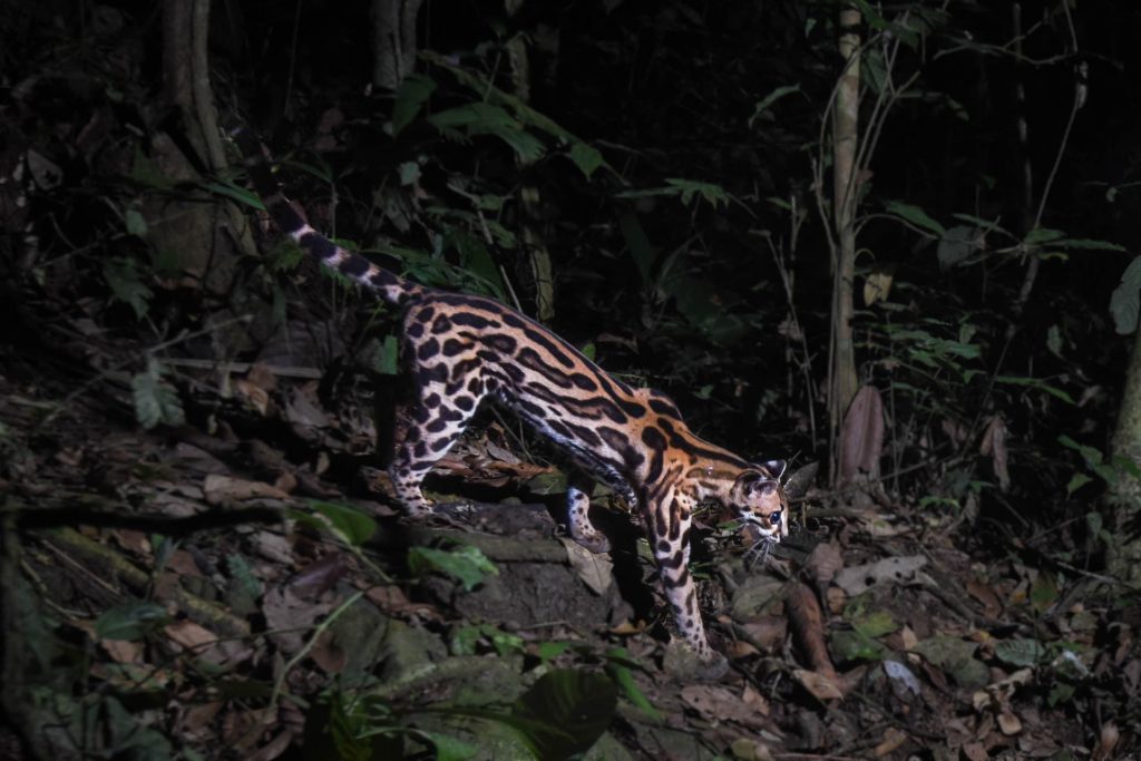
Margay (Leopardus wiedii) photographed on a camera trap in the Jama-Coaque Reserve.
Endangered Species Designations
The Jama-Coaque Reserve is designated as both a “Species Rarity Site” and “High Biodiversity Area” on Global Safety Net, an open-source science initiative that identifies “conservation imperative” sites that “harbor irreplaceable biodiversity.”
According to BirdLife International’s system of Key Biodiversity Areas (KBAs)—formerly known as Important Bird Areas (IBAs)—JCR is part of KBA “Bosques de Jama-Coaque en Manabí.”
Among the long list of endangered and threatened species that inhabit JCR, some of the more notable species include the Ecuadorian capuchin monkey (Cebus aequatorialis), which is listed as critically endanged on the IUCN Red List; birds like the gray-back hawk (Pseudastur occidentalis) and Chocó woodpecker (Dryobates chocoensis), which are listed as endangered on the IUCN Red List; the Mache glass frog (Cochranella mache), which is listed as critically endangered on the Ecuadorian Red List, and numerous critically-endangered plants and trees, including the rare hardwood species known locally as Amarillo (Centrolobium ochroxylum), which TMA is widely reproducing through its Regenerative Agroforestry program with local farmers.
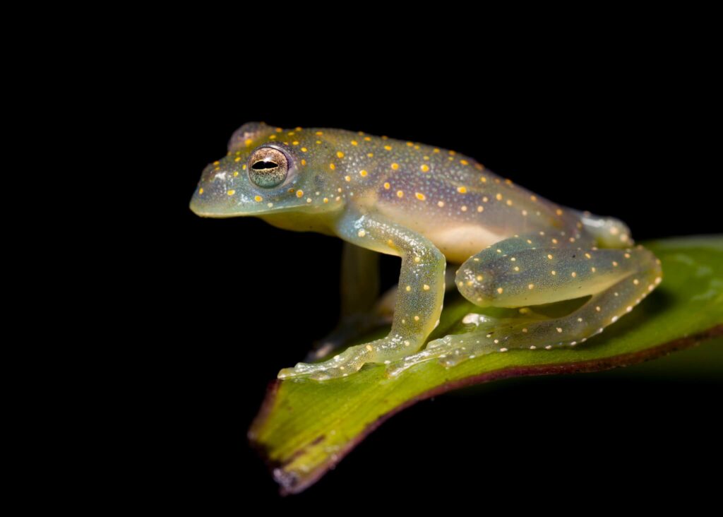
Mache glass frog (Cochranella mache) in the Jama-Coaque Reserve. Photo by Paolo David Escobar.
Research
Over the years, numerous biologists, ecologists, and agroforestry practitioners have conducted research in and around the Jama-Coaque Reserve (JCR). Check out Research Highlights from the Jama-Coaque Reserve to learn more.
Agroforestry and Ancient Nacional Cacao
TMA has been experimenting with cacao varieties and growing methods in agroforestry micro plots in JCR since 2008. Most notably, JCR currently contains the single largest repository of DNA-verified pure Ancient Nacional cacao in Ecuador, which it developed in partnership with To’ak Chocolate.
In total, TMA actively manage 9 experimental cacao plots with 5 different types of Nacional cacao in JCR, all of which were planted on land that was formerly developed for agroforestry by the previous landowners. All of these cacao plots collectively occupy a total of 5.2 hectares (13 acres) of land, although only 3.5 hectares (8.6 acres) are actively managed. This represents 0.3% of the total area of JCR.
The cacao varieties managed in these experimental plots are the same genetic varieties that TMA distributes to farmers throughout the Capuchin Corridor in its Regenerative Cacao program—featured in Smithsonian Magazine and Mongabay.
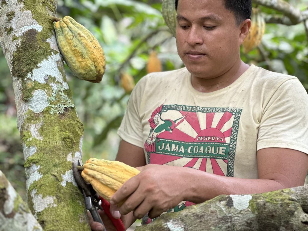
Dany Murillo (Reserve Manager) harvesting a cacao pod in the Jama-Coaque Reserve.
Reserve Management
The Jama-Coaque Reserve (JCR) is a private reserve established by the nonprofit conservation organization Third Millennium Alliance (TMA) and managed in partnership with the community of Camarones. TMA’s operating entity is incorporated in Ecuador under the name TMA-Ecuador. TMA is also incorporated in the U.S. as a 501c3 organization to facilitate international fundraising efforts. The president of TMA-Ecuador is Carla Rizzo from Quito. The executive director of TMA-US is Ryan Lynch from Fremont, California.
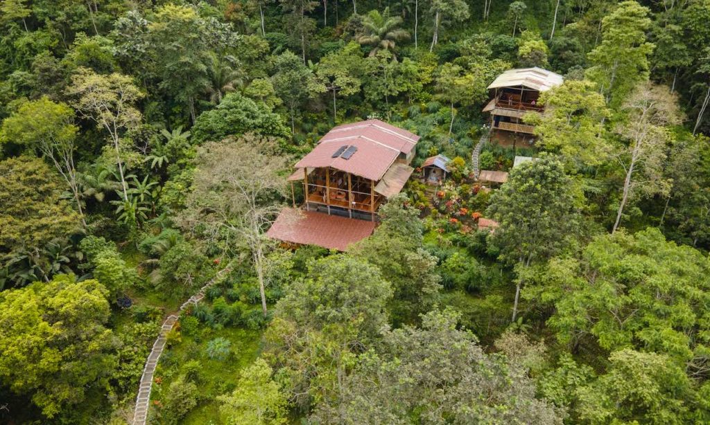
Food forest/regenerative agroforestry demostration site surrounding the Bamboo House
Bamboo House
The headquarters of JCR is the Bamboo House Research Station, which is fully off-the-grid but equipped with solar power, satellite internet, and the purest spring-fed water that you’ve ever tasted. The Bamboo House, along with the adjacent “Casita,” has a total of 8 bedrooms that can sleep up to 22 people.
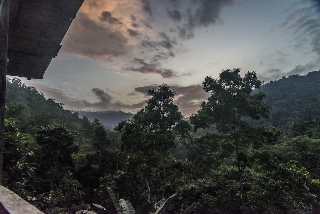
View from the balcony of the Bamboo House at dusk.
Capuchin Corridor
The Capuchin Corridor is a conservation initiative to protect one of the largest and least protected remnants of the Pacific Forest. It aims to connect the Jama-Coaque Reserve (JCR) to another forest preserve called Cerro Pata de Pájaro (PDP), which TMA also manages in partnership with local communities. This will create a contiguous 35,000-acre (14,000-hectare) rainforest preserve that spans the 27-mile (43-km) mountain range between the coastal towns of Jama and Pedernales at 0° latitude. It literally straddles both hemispheres, with the equator line passing through the center of it.
The total area of the Capuchin Corridor, which includes the homes and farms of 38 rural communities that are participating in the project, is 100,000 acres (40,000 hectares).
TMA is building the Capuchin Corridor in partnership with local communities through its Community Forests Program (in Spanish, Bosques Comunitarios). It’s a framework that provides local communities with a financial incentive to actively protect the forest in their own watersheds.
The Capuchin Corridor is named in honor of the critically endangered Ecuadorian Capuchin Monkey, a species that depends on this ecosystem for its continued existence.
